By Bret Wirta – The Incidental Explorer
Distance: 40 miles Time out: 5 days
Degree of Difficulty: The pinnacle is a technical climb Elevation: 7,980 ft. Pet Friendly: No

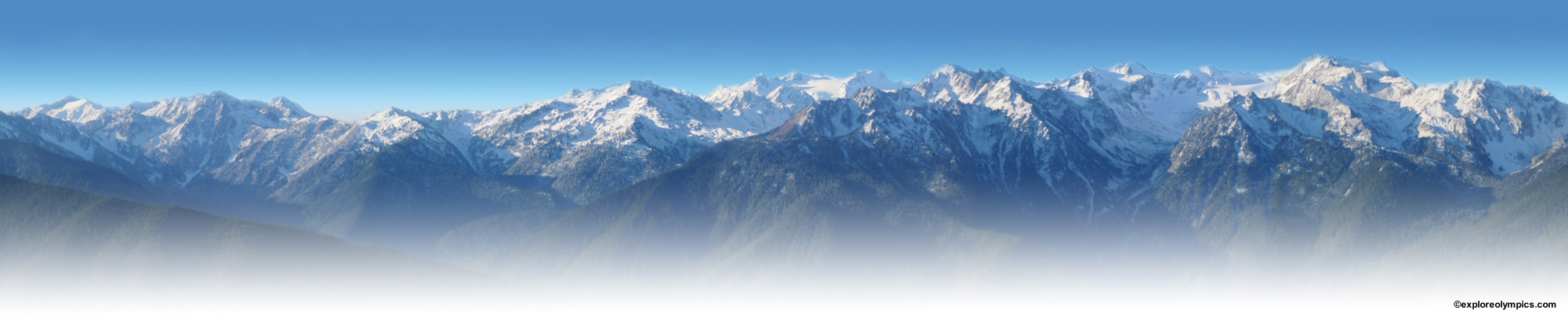
Mount Olympus from Grand Pass
July 2017. For years Mount Olympus, that peak with the mythical name, has whispered to me, loud enough that I was going to attempt to summit it for a third time. This year’s team would consist of my wife Trisha and our friends Tom and Danae, whose daughter, Elise, had volunteered to guide us. After an overnight stay at the Holiday Inn Express in Sequim, a detailed gear check, and a hearty breakfast at the Black Bear Diner, we were ready to drive to the trailhead.

Team Elliemo
Mount Olympus is the enigmatic heart of Olympic National Park. Even though Mount Olympus isn’t very high, it’s permanently clad in the ice of half a dozen glaciers whose icy meltwaters birth three of the Olympic Peninsula’s major rivers. Mount Olympus hides in the middle of a million acres of wilderness. It’s infrequently climbed and difficult to reach. I’ve had the privilege of climbing Olympus with past guides who had summited some of the most difficult peaks in the world, but their unfamiliarity with the local terrain, and their cavalier attitude toward Mount Olympus had made me anxious from the start. This time I felt confident in our guide, Elise. Not only is she a skilled technical climber who volunteers with search and rescue, but she’d scaled Olympus and respected the mountain.

Ellie show us our remote goal
Our journey to Mount Olympus began at the Hoh Visitor Center where we entered one of the few surviving Old Growth forests on the Olympic Peninsula. By the 1930’s, the Seattle Timber barons, who had clear-cut all the other ancient woodlands, were drooling at the massive trees still left along the upper Hoh. But thanks to a nationwide lobbying effort led by President Franklin D. Roosevelt, the United States Congress agreed to create Olympic National Park, and the big trees were saved.

Big Trees of the Hoh Rain Forest
You don’t lace up your boots in the parking lot and start summitting Mount Olympus. It’s a 17.5-mile journey just to reach basecamp, which thankfully, is a delightful hike through the Hoh Rain Forest. July was sunny and warm under the lush green canopy, but during the winter, this valley receives 12 to 14 feet of rain! We saw every shade of green fighting for sunshine. We brushed past gigantic ferns and walked under bearded tree branches shaggy with moss. We were surrounded by a riotous explosion of flora in this temperate rain forest, one of the last left in the United States.

Hike among the ferns
As we left the Hoh Visitor Center the noise of our civilized world was quickly replaced by the sounds of the forest – the soft thud of our boots, birds singing and water splashing. According to acoustic ecologist, Gordon Hempton, the Hoh Rainforest is home to the, “quietest square inch in the United States.” Silly? Perhaps not. Many studies conclude that noise pollution affects most areas of the United States and noisy environments contribute to elevated stress, stroke and heart attack. Listening to a gurgling stream may be more than a pleasant distraction, it may be good for you.

Pretty sight and pleasant sound
Our plan was for Elise, Tom and me to climb while Trisha and Danae would support us at base camp. We’d all enjoy spectacular scenery on the hike in – kind of like a mini-vacation. Whether you enjoy camping in the shelter of the woods or on the banks of a sunny river, there are plenty of designated camping areas on the way up to Mount Olympus. Each camping area has a toilet, surface water and – if you are below 3,500 feet and there is no ban – safe fire rings where you can enjoy the comradery of your friends around a small fire. Don’t forget to apply in advance for your permit at the Wilderness Desk at the Olympic National Park Visitor’s Center in Port Angeles.

Camping in the forest at Olympus Guard Station

Camping on the gravel bar at Olympus Guard Station
Do you believe that the younger generation are all indoors playing video games and that they are basically going to hell in a handbasket? If so, what you’ll see on the trail up to Mount Olympus will surprise you. Young people were everywhere! We chatted with Ranger Andy Harrington on the trail. He’s a dedicated advocate for Olympic National Park who energetically patrols the backcountry. But perhaps best of all, we met dozens of twenty and thirty-year-olds from all over the world, joyously experiencing the wilderness. We don’t have to wait for the torch to be passed. This steadfast generation is already becoming today’s stewards of our national parks.

Ellie, our climbing guide

Ranger Andy Harrington and Bret
At the end of our second day on the trail, when we were less than a half mile from our basecamp, we crested a ridge to find the entire valley had been blown out by a landslide. The only way through was to climb down a hundred-plus-foot-long wire and wood rung ladder dangling against the steep side of the ravine. By carefully stepping down on the swaying rungs, while keeping our balance by holding a rope tethered to a tree up on the rim, we all reached the streambed far below. Not such an easy task for the non-technical climbers in our group, but Trisha and Danae scampered down like Cirque du Soleil performers.

Trisha masters the ladder
We set up our base camp at Glacier Meadows. We left the pleasant summer weather below, for it was cloudy and cold with a threat of rain. There were only a few climbers besides us who were attempting to summit Mount Olympus. Perhaps Olympus isn’t as popular as other Northwest peaks, because it is such a long hike to base camp, or maybe it’s because the mountain is invisible to the cities that surround it on Puget Sound.

Trisha, Bret and Danae at Glacier Meadows basecamp
Mount Olympus is located in the middle of million-acre Olympic National Park and hidden by a semi-circle of other peaks. You can only see it from other Olympic Peninsula high-points, like this view from camp Boston Charlie on the Bailey Range, or from out to sea in the Pacific Ocean. It was the stunning sea-view that caused English captain John Meares to exclaim that the Greek Gods must live upon that icy mountain, when he first saw it in 1788. The name, the invisibility, the remoteness, all give this peak its fabled aura.
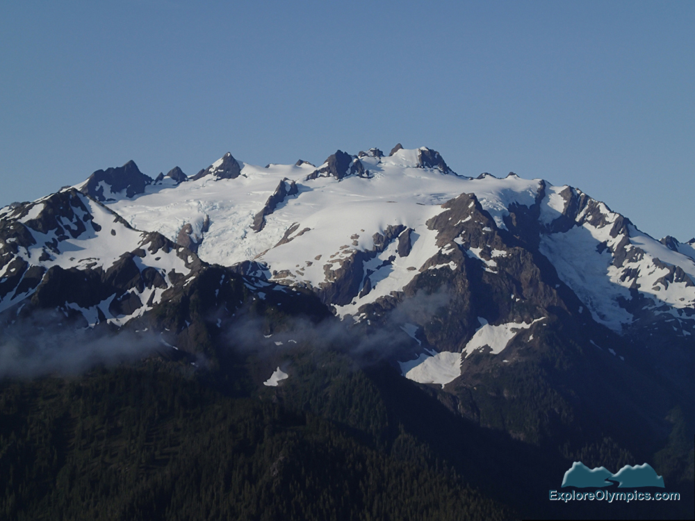
Mt Olympus from Camp Boston Charlie, Bailey Range
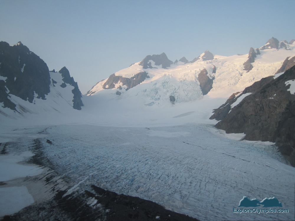
Though the summit of Mount Olympus is only 8,000 feet high, climbing it isn’t a romp through the daisies. The mountain is exceptionally prominent, technically challenging, and difficult to reach. Because of this trifecta, Mount Olympus is known to climbers as one of only ten, “Triple Crown” highpoints in the lower 48 states. Our plan was to reach Snow Dome by mid-morning (which is the white expanse in the lower half of the photo) and then avoid the dangerous crevasses and bergschrunds on our circuitous route to the summit.

Route from Snow Dome to the summit – J Gussman photo
The next morning, Elise, Tom and I were on the trail by 4am. The first obstacle was carefully traversing the loose rock and gravel of the lateral moraine down to the surface of Blue Glacier. Carefully descending the trackless moraine was surprisingly slow and difficult.

Slow going on lateral moraine of Blue Glacier
We climbed in the low clouds and couldn’t see much. Later in the morning, Trisha hiked the mile and a half from basecamp just in time to see the clouds part and the early morning sunshine strike Mount Olympus and Blue Glacier. She said the view from the lateral moraine was one of the most stunning in Olympic National Park.
Early morning view of Mount Olympus and Blue Glacier (photo from 2012 climb)
We roped up and quickly crossed Blue Glacier. The ice was not just blue on the surface, but deep in the fissures and cracks the glacier glowed with an eerie sapphire luminosity. On the other side, we walked off the glacier and began the steep climb up to Snow Dome. Elise carried her climbing rope slung over her shoulder like rounds of bandito ammunition. Dangling from the belt of her harnesses, where she could quick-draw for them, was a dizzying assortment of pulleys, carabiners, belay devices, anchors, nuts, hexes and cams. She wore a hard-shell helmet on her head and blue climbing boots with spiky crampons on her feet. She had a charming smile and big eyes. Elise reminded me of the sweet superhero that talks in a soft voice then kicks the bad guy’s butt.

Ellie leads the team
Elise was lead, Tom in the middle, and I brought up the rear. This was my third attempt to summit Olympus in the last five years. Perhaps Elise would be the difference this time? It was looking good so far. We had cleared the white plains of Snow Dome before noon. Tom was in great shape and I felt really good too. Best of all the clouds had dissipated and we could see plenty of blue sky.

Across Snow Dome
Elise kept a steady pace. The shorter, steeper route above Snow Dome wasn’t an option for us in July. Huge crevasses in the steep snow field, one above the other, made that direct approach too dangerous. Elise opted to swing around through Crystal Pass.

Tom and Bret in Crystal Pass
Much of mountain climbing is just a long slog. The difficulty can be staying in focus. Follow the pace of the leader. Don’t trip. Don’t let the climbing rope become too taut or too loose. Don’t step on the rope. And rest whenever you can.

Bret takes a rest stop literally
We climbed up the steep snowfield and squeezed through the crevasse at False Summit. Here the slabs of sandstone and slate were fractured and broken and slid beneath our feet, making our traverse treacherous. We worked together, less we start a landslide. We watched where we stepped and shouted when there was danger. Physical injuries prevent many teams from summiting (a team member fell and broke his ankle on my second Olympus attempt), but it’s personality issues that cause many climbing teams to fail. There was no conflict on our team. I respected Elise’s leadership and watched as Daughter gave orders and Dad responded without hesitation.

The steep climb to False Summit
We scrambled through the narrow defile of False Summit and down into a snow-choked saddle. Above us was one last snowfield, a steep ramp to the base of a naked pinnacle of rock that is the west peak, the true summit of Mount Olympus. I imagine that later in the season crossing the moat from the snow to rock might be an issue, but not for us. With one easy step, we crossed onto a rock ledge.

One last snowfield to climb
The peak of Mt. Olympus is a vertical pyramid of dense metamorphic rock. Tom and I are not technical climbers and so we looked up at the naked rock with trepidation. For this last few hundred feet, Elise would go first and set nuts and cams that would anchor the rope and prevent us two rookies from a deadly fall. Elise chose the size and type depending on the size, depth and shape of the crevasse so that when the rope tugged on the anchors, they set themselves even more firmly into the rock. With confidence in Elise’s knowledge and skills, I climbed quickly up the chute.

Bret just below the summit
The last obstacle was a two-foot overhang at the top. I couldn’t discern a dignified way up and over the ledge, so I flopped myself unceremoniously over. I finally stood on the summit of Mount Olympus. It felt great accomplishing this goal. The clouds had lifted and it was sunny and peaceful. I thought of the climbers and guides on my previous Mount Olympus teams and all the joy and comradery I’d experienced with them.

Bret standing on the summit of Mt Olympus
Soon all three of us were on the summit. Dad and daughter hi-fived. They were both so excited. I could see how joyful Elise was to be here with her Dad and how proud Tom was of his daughter.

Elise and Tom on the Summit of Mount Olympus
What a view! The Olympics spread out below us in a jumble of glaciated peaks and tree clad valleys. We knew the buzz and hum of civilization was down there somewhere, but we couldn’t see any signs of it. This was a view that hadn’t changed that much since the Cordilleran Ice Sheet retreated over 15,000 years ago. It was a view worthy of Zeus.

View from the summit of Mount Olympus
After signing the log book, I returned it to the metal chest that was nestled in the rocks. We were behind schedule, so we savored the view for only a bit longer before it was time to head down. Though Tom and I had never repelled off a mountain before, Elise confidently rigged up a belaying device and clipped me in. I stood on the edge of the overhang with my back to the open sky. I will admit it took my legs three tries before they pushed off the cliff. I fell backwards into bright blue sky. By releasing rope during a series of backwards leaps, followed by my legs absorbing the shock as I swung back into the rock, I was down on the snow at the base of the pinnacle in an instant.

Tom repelling off the summit of Mount Olympus
The rest of our adventure on Mount Olympus was just retracing our steps back to basecamp where we arrived at dusk. It had been a grueling 16.5-hour day, but thanks to Elise, we summited Mount Olympus. We toasted with Trisha and Danae. I was elated. It was a difficult journey, one that tested us sorely. No epiphany to report, but I do understand humanity’s need to challenge itself. It took me three tries, but I finally climbed that rascal. Almost making it to the top wasn’t good enough. I craved that feeling on the summit, that briefest moment of ecstasy when you stand where few others have stood and look out at all that is below.
We slept hard at our Glacier Meadows base camp that night and spent the next couple of days leisurely hiking back down the Hoh Valley trail. There was plenty of time for reflection. Though summiting Mount Olympus with Team Elliemo felt great, it wasn’t just a feat of bravado. I enjoyed climbing with Elise and Tom and the rest of the adventure with my wife, Trisha, and Danae. We forged a physical connection with this magnificent mountain and created an intimacy with yet another location inside this glorious gift to the world, Olympic National Park.
There is a common understanding among many Native American nations – wisdom sits in places. Learning and growing are tied to special locations. They are thin places. High in the sky and close to the heavens. Places that speak to us, not only of beauty, but of challenges. Mount Olympus is such a place to me. Philosopher Rene Daumel once said that when you climb you see, and when you must descend, at least you have known.
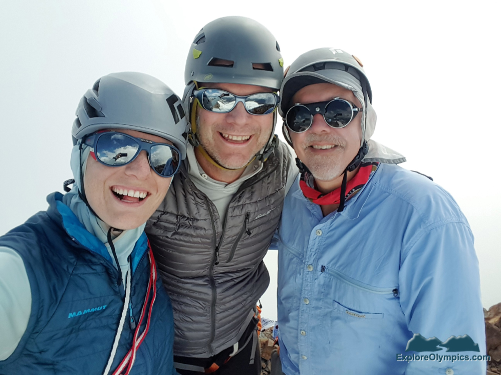
Team Elliemo on the summit of Mount Olympus
The End
Story by Bret Wirta
Photos by Bret Wirta, Elise Hollowed and Tom Hollowed.


