Mt. Jupitor: Elevation 5,701 ft.Elevation gain: 3,600 ft. Distance: 14.2 miles Time: 6 hrs. 20% alpine. Trailhead: 2,100 ft. Enjoyment rating: 3

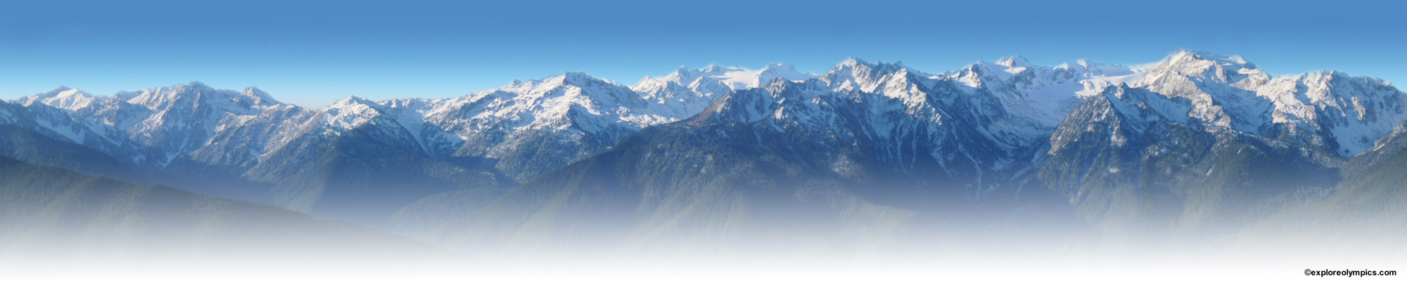
Mt. Jupitor, farthest peak and ridge, from Silver Lake Saddle.
Overview:This is a long 7.1 mile hike up a ridge, which separates the Duckabush and Dosewallips Rivers, to a mountain peak in the Brothers Wilderness which offers gorgeous views of the Brothers Peaks. All but the last mile is in heavy forest with only a few opportunities for viewpoints. But the last mile is very interesting and in good weather, provides stunningly beautiful panoramas. I tend to think of it as a good training hike with a grand reward at the end.
Getting to The Trailhead:From Hwy 101, one mile north of the Duckabush River Road and three miles south of the Dosewallips River Road, look for the Mount Jupitor road sign, turning west. The road number is (2610-010) but may not be on the sign. Stay on this road and follow the signs to the Mt. Jupitor trailhead on the right side of the road. Note that you have to cross private property on the first section of the Mt. Jupitor road and a gate, which is usually open, may be closed and locked.
The Trail:The trail immediately ascends the treed ridge separating the Duckabush and Dosewallips Rivers and then follows this ridge all the way to the peak. At one mile you can see Mt. Jupitor 6.2 miles ahead. Farther up the ridge you begin to get glimpses of The Brothers on the Duckabush side to the south and occassional views of Mt. Constance to the north. At 3.6 miles a prominate point to the left overlooks the Duckabush Valley and the rocky slopes of the Brothers. At 5.5 miles the trail enters the Brothers Wilderness and soon the trail becomes rockier and more open. The trail switchbacks often, through a sub-alpine environment of rock, mountain hemlock, subalpine fir, heather and wildflowers. Views from here improve at every turn and you feel that you are truly in the Olympic Wilderness.
The Peak:The final walk to the peak is relatively easy. At 7.1 miles the sandstone rocks and views from the top will make you want to stay as long as possible, especially on a clear sunny day. In 1969 a lookout cabin stood here but was destroyed in that year. Little reminders can still be seen. But the panorama around you is dramatic. Close to you, southwest, are the massive twin peaks of the Brothers. North is equally impressive Mt. Constance. And east is the panorama of the Puget Sound. On a clear day, Mt. Raineer, downtown Seattle, the San Juan Islands, Mt. Baker, the Cascades and the Hood Canal can all be seen.
The thumbnail images below can be viewed as a slide show, just click on an image to start slideshow. Click or tap on the right or left side of the image to view the next or previous image. Click or tap outside the slideshow image and the slideshow will close.
-

- Hood Canal and Puget Sound

-

- Mt. Jupitor, farthest peak and ridge, from Silver Lake Saddle.

To “Pin” an image, click the “Pin It” button and select image from list.